|
Illustrations of Land Surveys and Land Transfers Involving Noah and Jacob Tipton at Glen Savage, Allegheny Twp., Somerset Co., Pa. Showing Their Locations on a Present-day Land Parcel Map |
|
During the 1800s, our Tipton forefathers lived on and farmed several hundred acres of land south of the village of Glen
Savage in Allegheny Township, Somerset County, Pa. There is evidence that William, the first Tipton settler in this area,
came as early as 1804, but he and his family were here for sure by 1810. It seems, however, that they did not have
rightful ownership of this land for several decades. It wasn't until August of 1842 that William's son Noah (William had
moved west about 1827/1828) obtained rightful ownership of his land with three land pruchases totaling about 535 acres. |
|
The most surprising purchase he made was the tract of land on which it is believed Noah and his family lived, which he
purchased from Peter Shafer. It is written in the History of the Tipton Clan (1923 by Noah Tipton, grandson of
Noah Tipton above) regarding Noah Tipton's land: "The title to this land was later contested by Peter Shaffer . . .
who was at that time the closest neighbor. A settlement was made by Grand Father buying Shaffer a gallon of whiskey, and
they no doubt drank that together, for they close friends and neighbors." This statement has a bit of truth in
it, since the land Noah purchased from Peter Shafer was a tract that Shafer had just obtained the patent for less than
two months prior to the sale to Noah. It seems that Peter Shafer must have found out that Noah Tipton lived on unpatented
land, and he got title to the land. So whether it was a friendly transaction or one surrounded by hard feelings, Noah had
to buy his land from Shafer. |
|
It appears as if another one of Noah's land purchases was made under similar circumstances. Joseph Cohenour (modern
spelling is Coughenour) filed a land warrant on November 22, 1841, for a tract of land adjacent to Peter Shafer's land.
Joseph obtained the patent for this tract on July 1, 1842, and sold it to Noah just 55 days later, on August 25. This
tract and the Shafer tract are illustrated further down on this web page. |
|
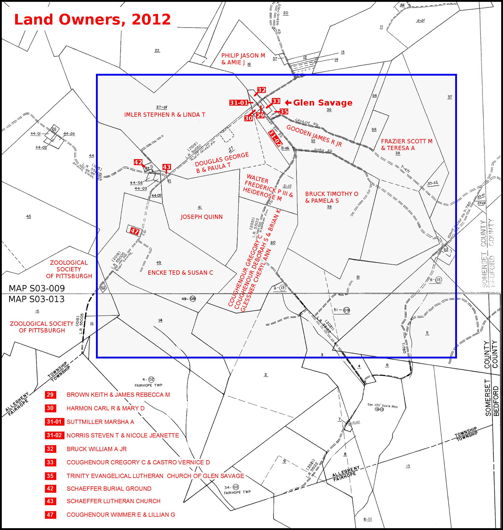
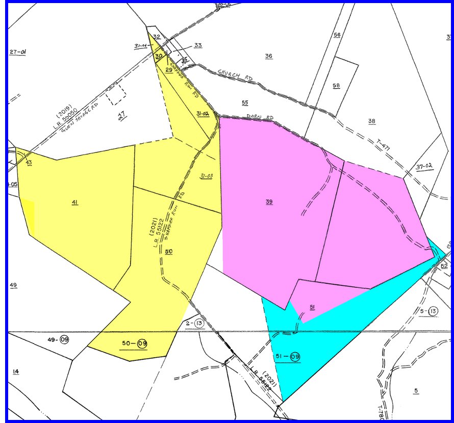
The map that is used on this web page to show the present-day locations of these lands
is the Land Parcel Map from the Somerset County Recorder of Deeds, with portions of
maps S03-009 and S03-013 combined. This map is not precise and differs somewhat
in some places from actual surveyor's measurements. The map below is for reference;
current (2012) parcel owners are shown in red. The parcel maps with blue outlines
that follow on this web page use a cropped area of this map from within the shaded area.
The village of Glen Savage is the cluster of small parcels
at the top of the shaded area. |
|
|
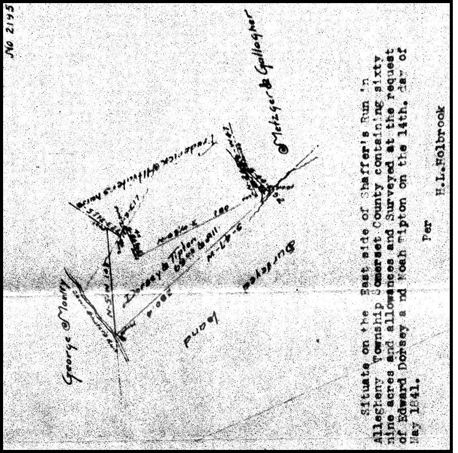
1841 Edward Dorsey and Noah Tipton Survey, 69 acres A deed for this land has not been found yet. Left: Old survey map made from a land survey for Edward Dorsey and Noah Tipton. These two men could have been business partners, perhaps in a logging operation. What happened to this tract after the survey is not yet known. The image is rotated for proper north-south orientation. Right: 2012 land parcel map showing this property in blue. |
|
|
|
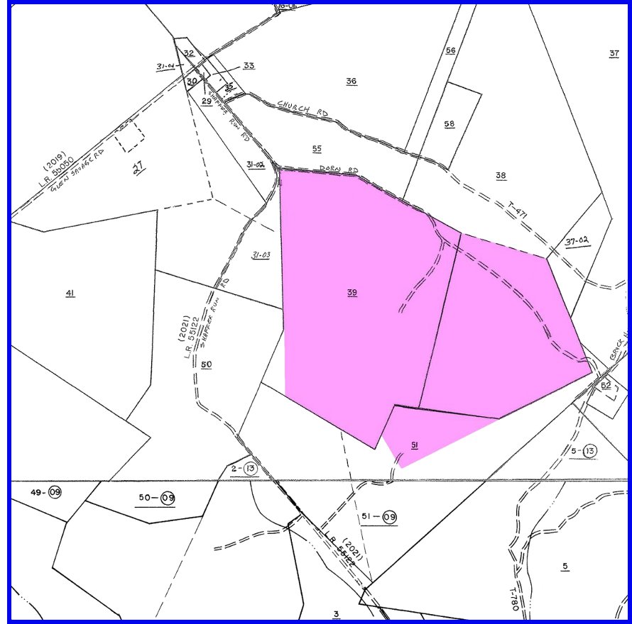
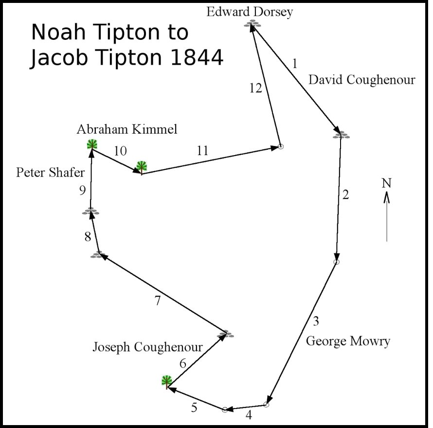
Note: On the tract outlines below that were drawn from surveyor's measurements recorded in the deeds, the numbers next to the boundary segments show the order of the segments as they were recorded in the deeds, and have no other significance. Landmarks where segments began and ended were trees   ,
stone piles ,
stone piles  , and posts , and posts  . .
|
|
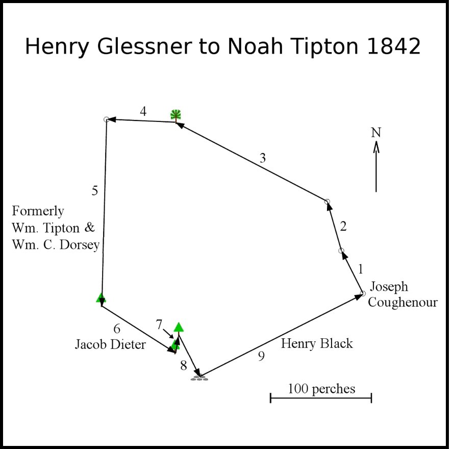
1842 Henry Glessner to Noah Tipton, 255 acres & 23 perches Noah purchased this land on August 6, 1842 from Henry Glessner, who lived in neighboring Brothersvalley Township. Henry had purchased this land January 11, 1840 from Frederick Oldfather. Henry held a mortgage on this property, with Noah obligated to pay him $100 on Christmas Day every year from 1843 through 1848, and then $125 dollars on Christmas Day 1849, for a total of $725. It is not yet known when or to whom Noah sold this land. It is probable that Nicholas Dorn, who emigrated from Germany in the mid-1800s with his family, settled on this tract. Also, it is believed that Henry Hartge and his son Frederick, who emmigrated with their families from Germany about 1857, settled here as well. Left: Outline drawn from surveyor's measurements taken from the deed. Right: 2012 land parcel map showing this property in pink. |
|
|
|
|
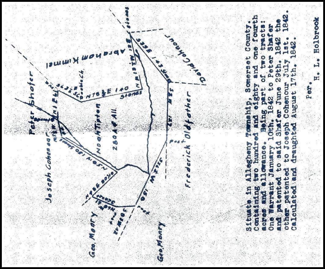
1842 Peter Shafer to Noah Tipton, 166.75 acres This land was part of a tract of 250 acres warranted by Peter Shafer on January 10, 1842, and patented to Peter on June 29, 1842. Peter sold it to Noah Tipton on August 23, 1842, only 17 days after Noah's land purchase from Henry Glessner (above). This is a portion of the land that Noah sells to his son Jacob in 1844. Left: Outline drawn from surveyor's measurements taken from the deed. Right: 2012 land parcel map showing this property in yellow. |
|
|
|
|
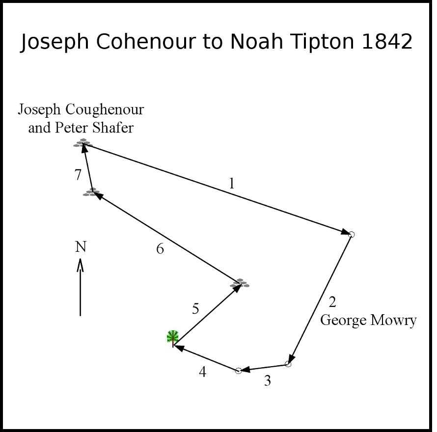
1842 Joseph Cohenour to Noah Tipton, 113.75 acres This land was part of a tract of 400 acres warranted to Joseph Cohenour on November 22, 1841, and patented to Joseph on July 1, 1842. Joseph sold it to Noah Tipton on August 25, 1842, two days after Noah purchased the Peter Shafer land (above). This is also a portion of the land that Noah sells to his son Jacob in 1844. Left: Outline drawn from surveyor's measurements taken from the deed. Right: 2012 land parcel map showing this property in yellow. |
|
|
|
|
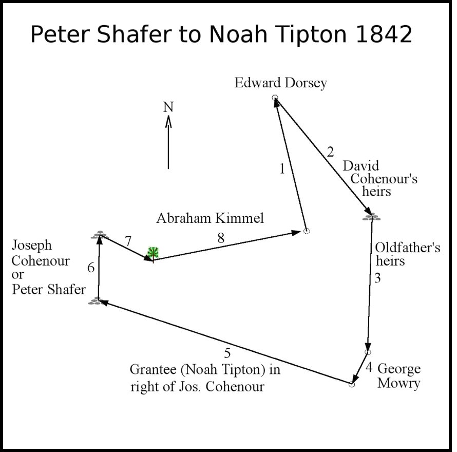
Noah Tipton's Survey of 1842 Below is a survey map of Noah's land that includes the purchases from Peter Shafer and Joseph Cohenour. This map is dated Aug. 17, 1842, which predates the purchase from Shafer by six days and the purchase from Cohenour by eight days; It was probably made in preparation of the deed transfers. The stream running north to south is Shaffers Run. Note that this map shows Frederick Oldfather owning the land to the east even though Noah had recently purchased this land (see 1842 Henry Glessner to Noah Tipton, above). The image is rotated for proper north-south orientation. |
||
|
||
|
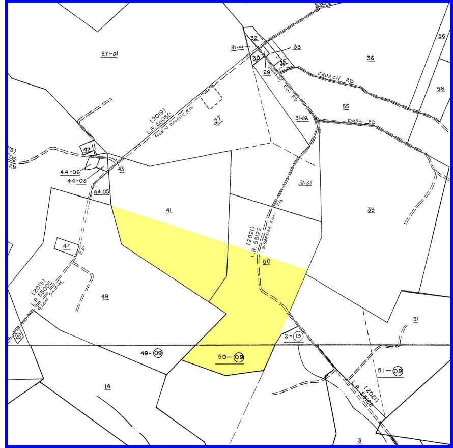
1844/1851 Noah Tipton to Jacob Tipton, 288.25 acres There are two deeds from Noah Tipton to his son Jacob Tipton that are nearly identical, one dated 26 April 1844 and recorded 29 April 1844, and the other dated 3 June 1851 and recorded 25 August 1851. They have nearly the same wording and exactly the same surveyor's measurements. The notable difference between these deeds is that the 1844 deed has Noah living in Allegheny Township, Somerset County, and the 1851 deed has Noah living in Bedford County. It was between 1844 and 1850 that Noah had moved his family about four miles east, to Londonderry Township, Bedford County (they later moved to Illinois about 1863/64). The reason for the deed duplication is not known. Left: Outline drawn from surveyor's measurements taken from the deed. Right: 2012 land parcel map showing this property in yellow. |
|
|
|
|
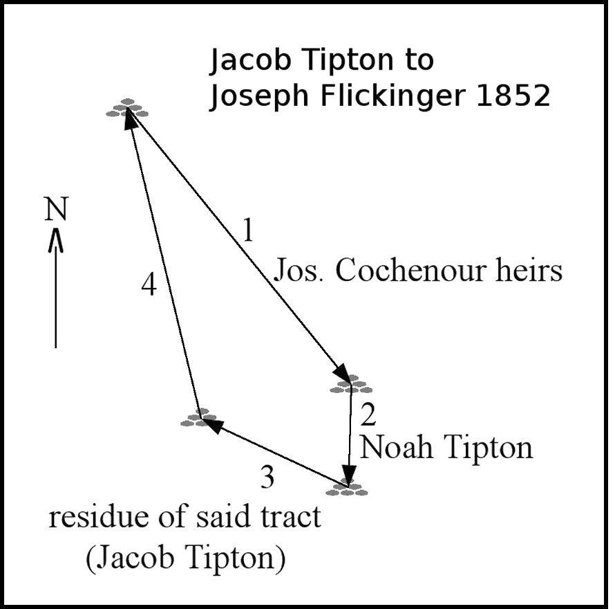
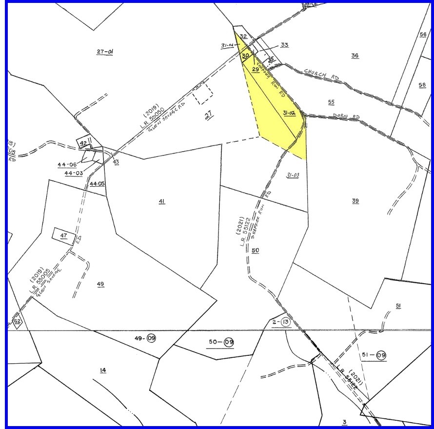
1852 Jacob Tipton to Joseph Flickinger, 31.8 acres Jacob sold a portion of the land he had purchased from his father Noah. The Glen Savage school at that time was on this tract near the northern tip. Left: Outline drawn from surveyor's measurements taken from the deed. Right: 2012 land parcel map showing this property in yellow. |
|
|
|
|
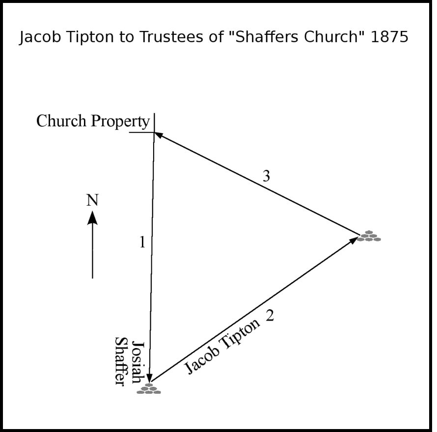
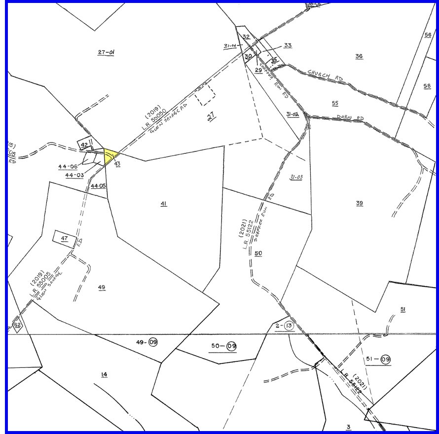
1875 Jacob Tipton to Trustees of "Shaffers Church", 1.47 acres Jacob sold off a small portion of his land (parcel 43) to the Shaffer Church. The church property at the northwest corner of this parcel contains the Shaffer Church cemetery, where Jacob and wife Lucinda are buried. Left: Outline drawn from surveyor's measurements taken from the deed. Right: 2012 land parcel map showing this property in yellow. |
|
|
|
|
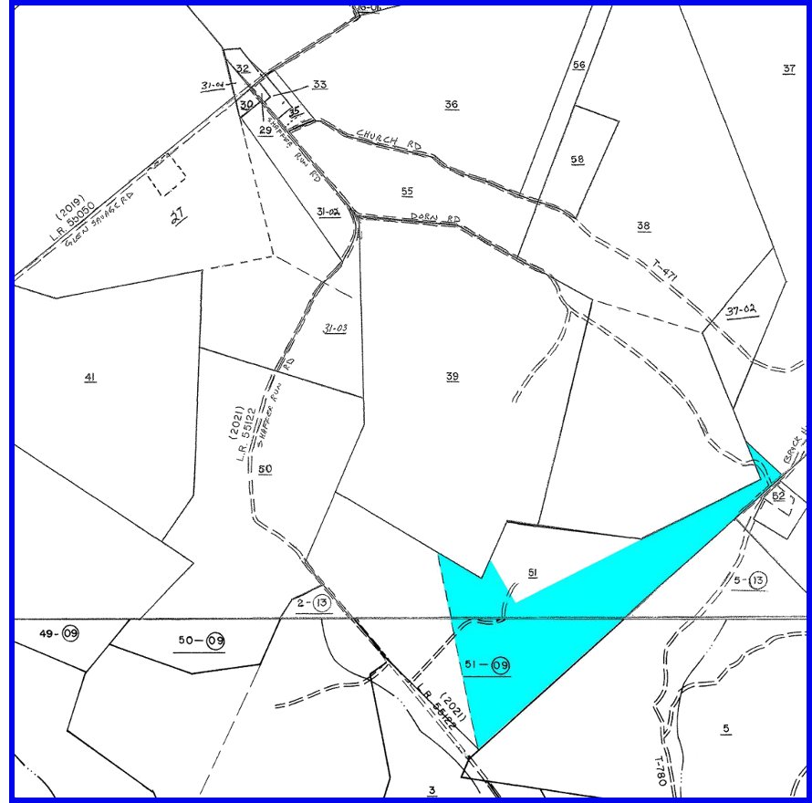
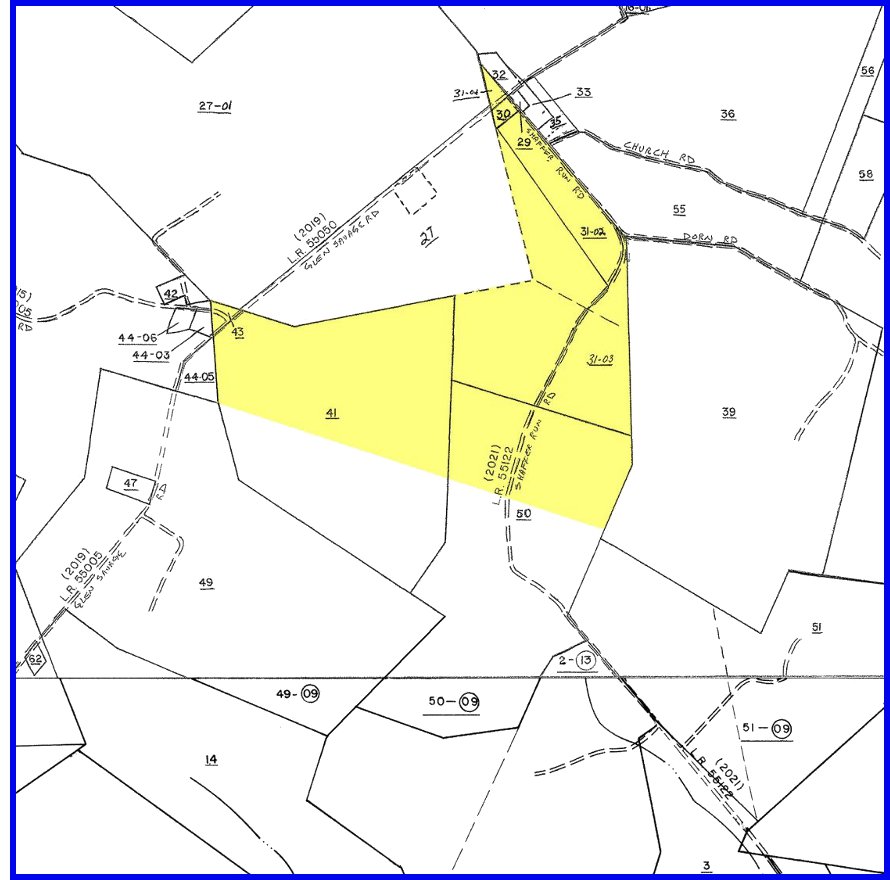
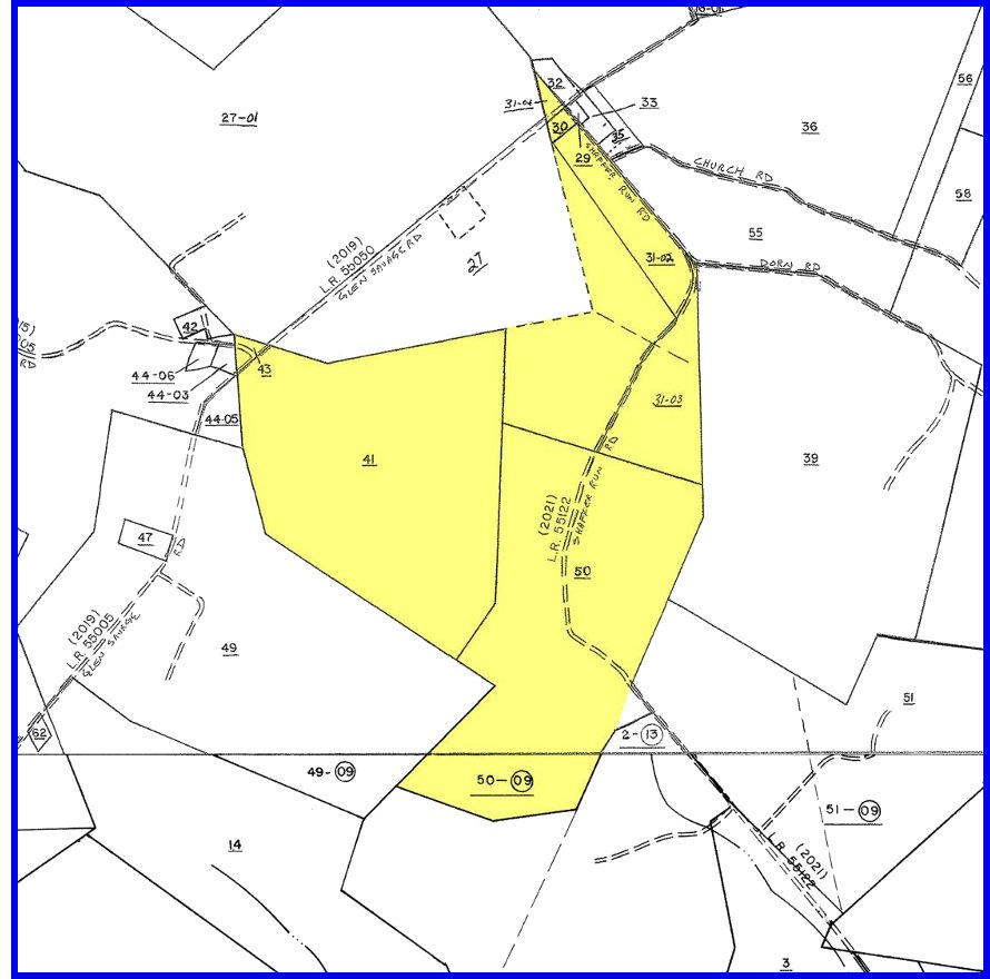
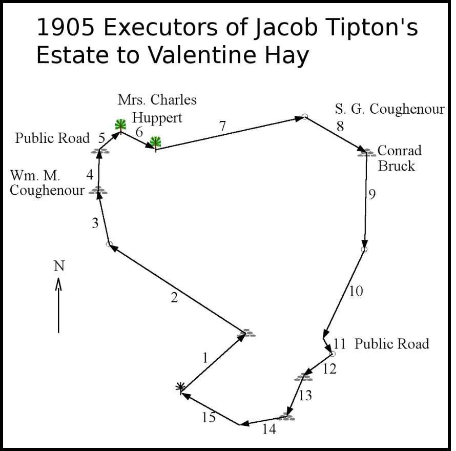
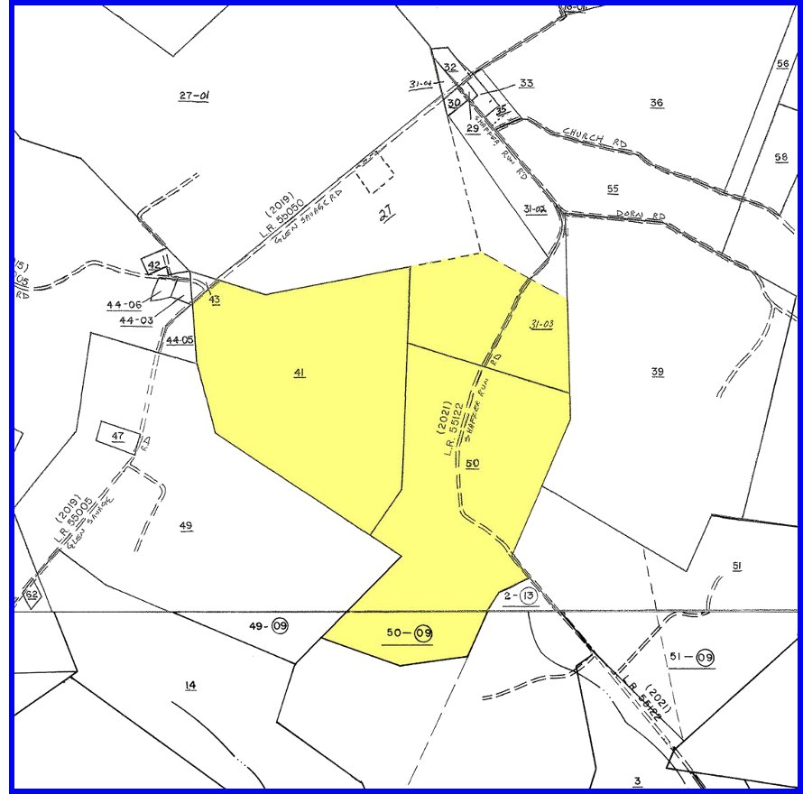
1905 Executors of Jacob Tipton's Estate to Valentine Hay, 278 acres & 36 perches In addition to the sales to Joseph Flickinger in 1852 and to the Shaffer Church in 1875, Jacob had added a small triangle of land along the southeast side of his property (date unknown). Jacob died in 1903 and his sons James and Noah, as executors of Jacob's estate, sold Jacob's land in 1905 to Valentine Hay, who was a lawyer living in Somerset Borough. No doubt Valentine was land speculating and planned on selling this land for a profit. This could explain how this land eventually became subdivided into three parcels, numbered 41, 31-03, amd 50 on the present-day land parcel map. Left: Outline drawn from surveyor's measurements taken from the deed. The public road at upper left is Glen Savage Road. The public road at lower right is Shaffers Run Road. Right: 2012 land parcel map showing this property in yellow. |
|
|
|
|
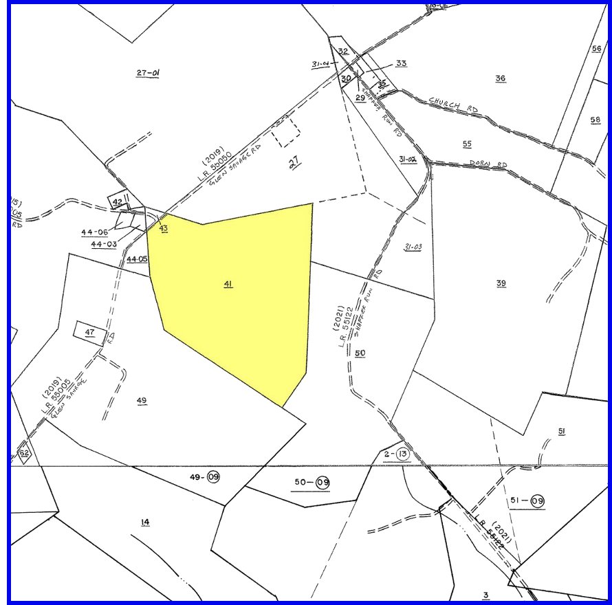
Parcel 41 There is an unresolved issue regarding the 1905 sale to Valentine Hay. It is known that parcel 41 (107.33 acres, colored yellow in the map on right) was owned by Emma M. (Tipton) Powell (1884-1965), granddaughter of Jacob Tipton. The parcel was passed on to her daughter, Flora Lorene (Powell) Hoppert (1918-1999) and then to Flora Lorene's three children. From this information it was assumed that the parcel had always stayed in the Tipton family, going from Jacob to his son James (1860-1938) and then to James' daughter Emma. How this parcel got back into the Tipton family after the sale to Valentine Hay is unknown. One theory is that this parcel was split off from the larger tract and bought back by the Tipton family because the original Tipton homestead was on this parcel. |
|
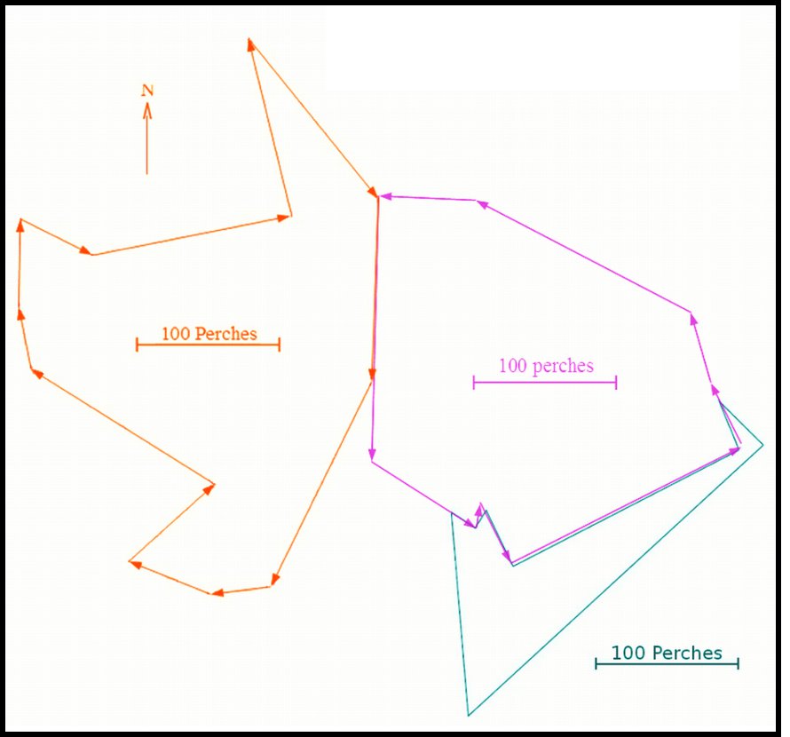
| Noah Tipton's Lands Shown Together | |||
| Outlines on left: |
Blue Pink Orange |
1841 Edward Dorsey & Noah Tipton Survey 1842 Noah Tipton's purchase from Henry Glessner 1842 Peter Shafer to Noah Tipton + 1842 Joseph Coughenour to Noah Tipton, same as 1844/1851 Noah Tipton to Jacob Tipton |
|
| 2012 land parcel map on right: Blue, pink, and yellow areas correspond to blue, pink, and orange outines at left. | |||
|
|
||
|
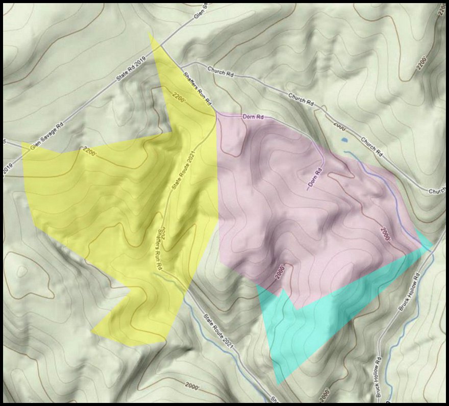
Terrain of Noah Tipton's Lands Below we give some personality to Noah's lands by overlaying the colors used in the parcel map above right onto a terrain map. Note Dorn Road near the center, named for the Dorn family who settled here in the mid-1800s. |
||
|
||